
Introduction
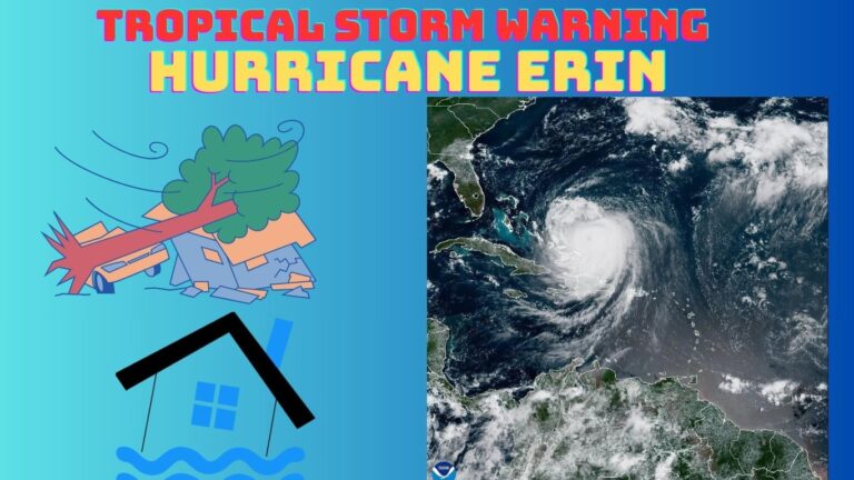
Hurricane Erin, the first Atlantic hurricane of the 2025 season, stunned meteorologists and communities alike with its unprecedented rapid intensification and massive size. Escalating from a tropical storm to a Category 5 hurricane in just over 24 hours—one of the fastest intensifications in Atlantic history—Erin became a stark reminder of the growing power of climate-driven storms. Although it spared the U.S. mainland from direct landfall, its expansive wind field triggered life-threatening rip currents, coastal flooding, and emergency declarations across the Caribbean and U.S. East Coast. This comprehensive guide provides real-time updates, expert insights into climate trends, advancements in AI-based forecasting, and practical safety tips to ensure preparedness.

Erin at a Glance: Meteorological Overview
Origin and Explosive Growth
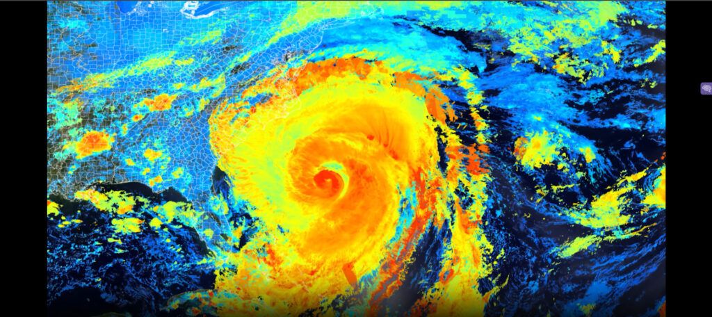
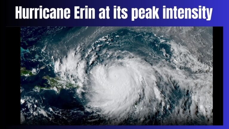
Erin emerged as a tropical wave off the coast of West Africa on August 9, 2025, organizing into Tropical Storm Erin by August 11. Fueled by exceptionally warm sea surface temperatures (SSTs) of 29–30°C and low wind shear, it rapidly intensified into a Category 5 hurricane by August 16, achieving maximum sustained winds of 160 mph (260 km/h) and a central pressure of 917 mb—a rare metric for August storms. This intensification, defined as a wind speed increase of at least 35 mph in 24 hours, ranks among the fastest in Atlantic records, comparable to Hurricane Wilma (2005).
NOAA’s National Hurricane Center (NHC) for official storm data.
Understanding Rapid Intensification in Hurricanes.
Strength and Size Fluctuations
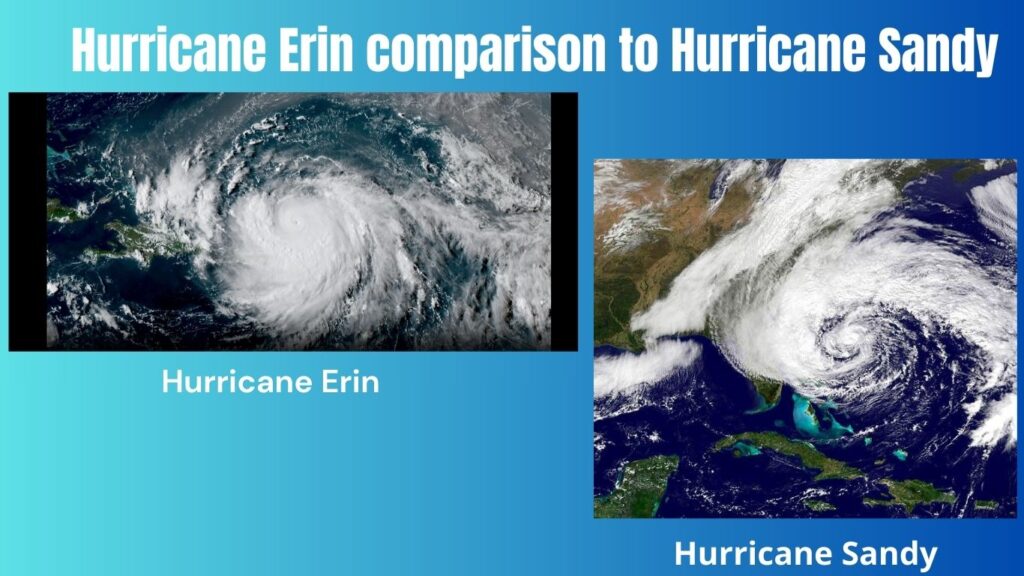
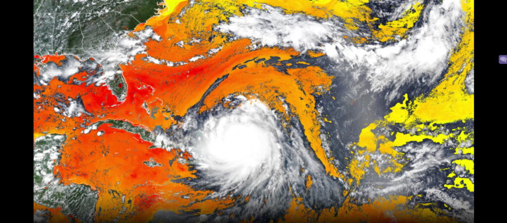
After reaching Category 5, Erin underwent multiple eyewall replacement cycles, weakening to Category 3 by August 17 before restrengthening to Category 4. By August 22, it transitioned into a post-tropical cyclone as it moved over cooler waters. Erin’s tropical-storm-force winds extended up to 650 miles across, making it one of the largest Atlantic hurricanes on record, surpassed only by Hurricane Sandy (2012). Its sheer size amplified its impacts, even without direct landfall.
Climate Drivers of Rapid Intensification
Erin’s explosive growth reflects a broader trend in hurricane behavior driven by climate change. Research from the Intergovernmental Panel on Climate Change (IPCC) indicates that rapid intensification events have become five times more frequent since the 1980s, driven by warmer SSTs, reduced wind shear, and higher atmospheric moisture. In 2025, Atlantic SSTs averaged 1.5°C above pre-industrial levels, creating ideal conditions for storms like Erin to escalate rapidly. These conditions also increase the likelihood of stronger, wetter, and slower-moving hurricanes, amplifying flooding risks.
IPCC Sixth Assessment Report for climate change impacts.
How Climate Change Fuels Extreme Weather.
Enhanced Forecasting: AI Models Revolutionizing Predictions
Forecasting Erin’s erratic behavior challenged traditional models like the GFS and ECMWF, which struggled to predict its rapid intensification. However, Google DeepMind’s experimental AI model outperformed these tools, accurately predicting Erin’s track and intensity over the first 72 hours and remaining competitive through five days. By analyzing decades of hurricane data and recognizing subtle atmospheric patterns, AI models identify signals that human forecasters and conventional models might miss. While not yet publicly available, this technology signals a paradigm shift in hurricane forecasting, potentially saving lives through earlier and more accurate warnings.
Google DeepMind’s AI Weather Research.
Coastlines on Edge: Warnings and Impacts
Caribbean Devastation
Erin’s outer bands brought torrential rainfall, flash flooding, and widespread power outages to Puerto Rico, the U.S. Virgin Islands, and the northern Leeward Islands. In the Cabo Verde Islands, where Erin formed, flooding caused nine fatalities and prompted a national disaster declaration. Emergency measures included mandatory evacuations and shelter activations across the region.
AP News Coverage of Erin’s Caribbean Impacts.
Hurricane Impacts in the Caribbean.
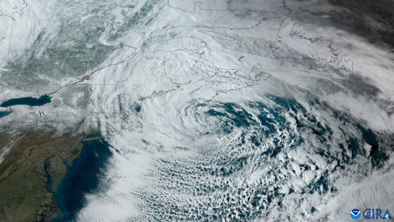
U.S. East Coast Hazards
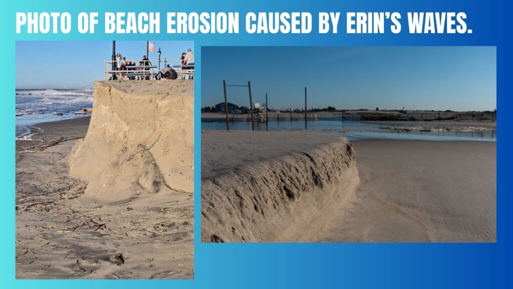
Despite remaining offshore, Erin’s massive size generated life-threatening rip currents, 8- to 20-foot waves, and significant beach erosion from Florida to New England. In North Carolina’s Outer Banks, tropical storm conditions led to mandatory evacuations for Hatteras and Ocracoke Islands, with Highway 12 at risk of flooding. Coastal flood warnings extended as far north as Maine, underscoring Erin’s far-reaching influence.
The Washington Post on Erin’s Coastal Impacts.
Coastal Flooding Preparedness Tips.
Why Size Equals Seriousness
Erin’s expansive wind field demonstrated that hurricanes don’t need to make landfall to pose significant threats. Its impacts stretched hundreds of miles, affecting coastal communities with flooding, erosion, and hazardous surf. This underscores the need for preparedness even in areas far from a storm’s center.
Comprehensive Safety and Preparedness Guide
Hurricane season demands proactive preparation. Follow these expert-recommended tips from NOAA and FEMA to stay safe:
- Understand Local Risks: Even distant storms can cause coastal flooding, rip currents, and erosion. Use FEMA’s Flood Map Service to check your area’s risk.
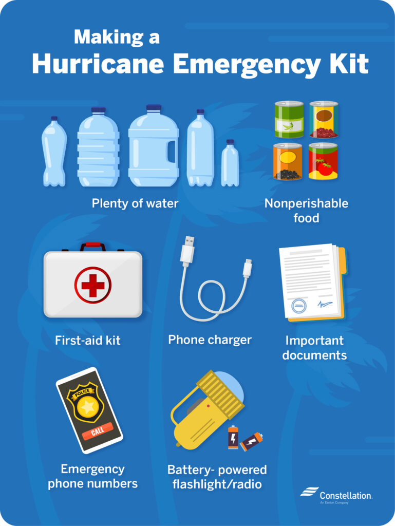
- Build an Emergency Kit: Stock at least 72 hours of non-perishable food, water (1 gallon per person per day), medications, flashlights, batteries, first-aid supplies, and hygiene items.
- Secure Property: Anchor outdoor furniture, trash bins, and other items to prevent wind damage. Reinforce windows and doors in flood-prone areas.
- Stay Informed: Monitor updates from the National Hurricane Center, NOAA, or local weather services. Use apps like NOAA Weather Radar or portable radios for real-time alerts.
- Plan for Evacuation: Know your evacuation routes and establish a family communication plan. Keep devices charged with portable power banks and maintain a list of emergency contacts.
Ready.gov Hurricane Preparedness.
Frequently Asked Questions
| Question | Answer |
| How fast did Erin intensify? | Erin surged from a tropical storm to a Category 5 hurricane in just over 24 hours, one of the fastest intensifications on record. |
| Can offshore hurricanes affect the U.S.? | Yes, Erin caused dangerous rip currents, high surf, and coastal flooding along the East Coast despite staying offshore. |
| How does climate change impact hurricanes? | Warmer oceans and increased atmospheric moisture fuel more frequent and intense storms, with rapid intensification becoming more common. |
| Are AI models improving forecasts? | Google DeepMind’s AI outperformed traditional models in predicting Erin’s path and intensity, suggesting a future for enhanced forecasting. |
| What should I include in an emergency kit? | Stock non-perishable food, water, medications, flashlights, batteries, and hygiene supplies for at least 72 hours. |
About the Author
Sources
- National Hurricane Center (NHC)
- NOAA NESDIS
- The Washington Post
- Virginia Tech News
- AccuWeather
- IPCC Sixth Assessment Report
You Can Read More Such Articles :
Hurricane Gil 2025 , Fantastic Four Box Office , Hurricane Gil , Labubu Big Into Energy Secret , Dale Gribble , King Of The Hill Dale , Lake Piru California , Global Citizen Fest Tickets , NBA Summer League Las Vegas Tickets , Quotes for Snowfall 2025 , Farmers Almanac Winter Forecast for 2025–2026 , Hurricane Erin 2025 Tracker , Milwaukee Flooding , Times Square Shooting , Fortnite New Season Tropical Storm Hurricane Erin , 2025 Lego Batman Batmobile,Tropical Storm Warning: Hurricane , Google Pixel 10 Pro , Millie Bobby Brown Baby , North West Fashion , Gears of War Reloaded , Alcaraz’s Bold New Look , Taylor Swift Engaged ?


3 thoughts on “Hurricane Erin 2025: Live Updates, AI Forecasts & Safety Tips”